NSW Maritime have released their boating maps in PDF format for download from their website. On this DVD, these maps have been converted to our OZF format for easy use with OziExplorer and OziExplorerCE. NOTE: The calibrated OZF maps on this DVD can only be used with OziExplorer, OziExplorerCE and OziExplorer Android. Also on the DVD are the original PDF maps and the maps converted to the standard image format PNG.
NSW Maritime Boating Maps on DVD - $33 AUD (includes GST and postage).If you do not have a PayPal account you can still purchase using this PayPal link. On the Purchase Form, click the "Continue" link and follow the prompts. (To purchase these maps along with other products, go to our Australian Purchase page here) |
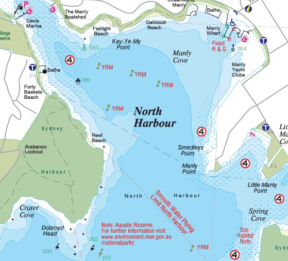
Example Map Section of these Boating Maps -
Maps on the NSW Maritime Boating Maps DVD
For more details see the NSW Maritime website, here is the link NSW Maritime website
Coastal Areas - 14 maps of 7 regions covering the NSW coast
Hawkesbury River / Broken Bay - 8 maps
Hunter Inland - 8 maps of 4 inland lakes and rivers of the Hunter region
Inland Dams - 26 maps of 15 inland dams
North Coast - 15 maps of 9 river areas on the northern NSW coast
South Coast - 15 maps of 9 river, bay and harbour areas on the southern NSW coast
Sydney - 8 maps
The OZF format maps on this DVD will only work with PC OziExplorer, OziExplorerCE and OziExplorer Android.