|
Home | Ozi Home | Features | Screen Shots | Optional Extras | Development | GPS FAQ | Support | |
This page describes how to use the Internet Maps with OziExplorer.
The use of the Internet Maps within OziExplorer can be considered experimental at this stage, if it doesn't work out some or all of the maps may need to be removed in a future version.
You need an internet connection to use Internet Maps. The map image tiles are downloaded in real time from the internet and stored in a file cache.
Tiles which have already been cached can be used when offline.
You also need to download the Internet Maps.map file (see below).
http://bingmaps.com.au/index.aspx
Norway Maps
Topographic and marine maps of Norway.
You must be using at least OziExplorer release version 3.95.5d. Check the "Help / About" option in OziExplorer to see what version you are currently running.
The OziExplorer development version does not yet work with Internet Maps but will in the future.
Notes : Prior to purchasing OziExplorer, the Internet Maps can be used in the OziExplorer Trial version (not the Shareware Demo).
*** You need to download the "Internet Maps.map" file ***
![]() Download self installing setup file -
download map file here
Download self installing setup file -
download map file here
Certain parameters such user agent, version numbers can be controlled by a
text file im.dat - Download from here - download
IM.DAT file here
Unzip the file and put it in the OziExplorer folder. The file can be edited with
a text editor.
Run the downloaded setup file to install the map. It is installed in the Internet Maps folder (under the Maps folder).
Open the "Internet Maps.map" map file in OziExplorer in the usual way.
Do not try to recalibrate the map or change the map border, there is no need they are fixed in the software.
First you need to open the "Internet Maps.map" file in the usual way (Load Menu / Load Map File)
(Note: an explanation of the modes is above)
![]() Select Map Type - Select one of the different Map Types available.
Select Map Type - Select one of the different Map Types available.
![]() Draw Screen
- Redraws the screen if it has not refreshed properly.
Draw Screen
- Redraws the screen if it has not refreshed properly.
![]() Zoom In - Zooms Google
Maps in to show more detail, click the button
to zoom in.
Zoom In - Zooms Google
Maps in to show more detail, click the button
to zoom in.
![]() Zoom Out - Zooms Google
Maps out to show a wider view, click the button
to zoom out.
Zoom Out - Zooms Google
Maps out to show a wider view, click the button
to zoom out.
![]() Zoom
Level - Select the required zoom level from the drop down menu.
Zoom
Level - Select the required zoom level from the drop down menu.
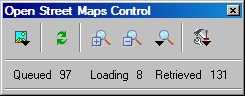
![]() Show Options - Shows the Tile downloading Statistics or the Configuration
screen.
Show Options - Shows the Tile downloading Statistics or the Configuration
screen.
It can be difficult to move to the location you are interested. If you have waypoints for the area you can load them and use the "Plot Location...." button on the wp list toolbar to move the map to its location.
You could also use Name search if you have a names database.
Saving of the available maps is not possible.