This download includes all the New Zealand Nautical Charts from the NZ202 chart catalogue. (See the link below for the coverage).
The link will be emailed to download the maps -
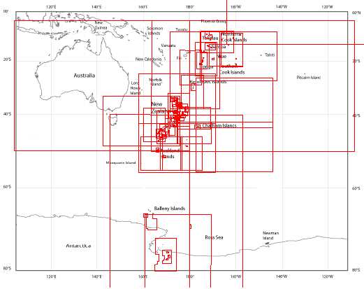
The charts are sourced from Land Information New Zealand (LINZ), the New Zealand Hydrographic Authority who produces official nautical charts to aid navigation. This December 2016 chart catalogue has in excess of 170 individual charts (320 including the detailed harbour and anchorage maps) all included in the download. The charts vary in scale from 1:7 500 to 1:10 000 000 for the broader region charts. Also includes Tonga, Samoa, Southern Ocean and Ross Sea.
The maps use the World Geodetic Datum (WGS84) and the Mercator and Transverse Mercator projection which are both supported in OziExplorer.
Sourced from LINZ NZ202 Chart Catalogue. Crown Copyright Reserved
NOTE: These maps are in OziExplorer's OZF4 format suitable for OziExplorer, OziExplorerCE and OziExplorer Android.
LINZ NZ202 Nautical Charts for NZ and surrounding regions download - $19 AUD.(If you do not have a PayPal account you can still purchase using this PayPal link. On the Purchase Form, click the "Continue" link and follow the prompts.) |
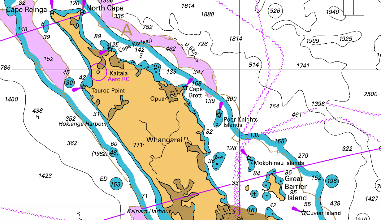
Example Map Section 1:40 000 - NZ202
Example Map Section 1:3.5 M - NZ202
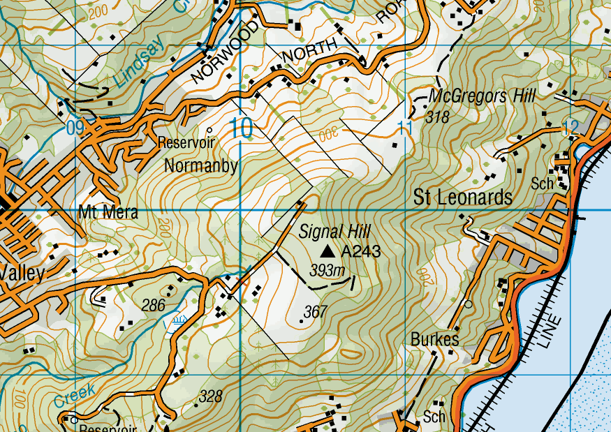
This download includes all the topographic map series (1:50,000 scale and 1:250,000 scale) for the New Zealand mainland and Chatham Islands.
The link will be emailed to download the maps -
The NZ national map series release has more than 40 x Topo250 and 445 x Topo50 maps on the DVD. These are the latest maps and replace the older NZMS260 and NZM262 series.
The maps use the New Zealand Geodetic Datum 2000 (NZGD2000) and the New Zealand Transverse Mercator 2000 (NZTM2000) projection which are both supported in OziExplorer v3.95.5g and later versions (if you have an earlier version of OziExplorer, an update can be downloaded from the OziExplorer page of our website.
Sourced from LINZ Topo50 and Topo250 Map Series. Crown Copyright Reserved
NOTE: These maps are ONLY in OziExplorer's OZFx3 format suitable for OziExplorer, OziExplorerCE and OziExplorer Android.
Topo250 and Topo50 maps covering all of NZ download - $19 AUD(If you do not have a PayPal account you can still purchase using this PayPal link. On the Purchase Form, click the "Continue" link and follow the prompts.) |
Some free maps may be downloaded from this site.
University of Texas Library Online - Free maps of Oceania Region and listing of other maps available. These maps will require calibrating within OziExplorer using the Load and Calibrate option.
Note: For unregistered users: You will need to use the Trial version to use these maps, the unregistered Shareware Demo version cannot be used with these images. (The Trial version is included in the OziExplorer Software download.).
GeoSystems - Software and Maps - NZ260 and NZ262 Digital Map Series